P5 Snowplow

MTV

Member
:
2002 Proteg 5
SP_A0511.jpg
 
I live in the perfect place. It snows here but melts away with in a day or two.
 

Attachments

  • 12-09-07_0802.webp
    12-09-07_0802.webp
    55.8 KB · Views: 713
  • DCP_3704 (Medium).webp
    DCP_3704 (Medium).webp
    56.3 KB · Views: 715
Winter sure has its ups and downs... But I just loved driving in the snowstorm last night! weeeeeee!!!
 
it just snowed about 12-14 inches over the last week here. they canceled classes (at washington state university) for the first time since 1985. lol.
 
We're predicted to get 4 - 12 inches tonight depending on elevation. Since I'm over 5 thousand feet I figure I'll get around 5 or 6 inches of snow. Then it will be gone by Monday.
 
We're predicted to get 4 - 12 inches tonight depending on elevation. Since I'm over 5 thousand feet I figure I'll get around 5 or 6 inches of snow. Then it will be gone by Monday.

Lucky that it goes away so fast.

How is it possible that you get snow in Arizona?
 
Lucky that it goes away so fast.

How is it possible that you get snow in Arizona?

Arizona has 3 ski resorts as well. I love the misconception that all of AZ is like the sahara desert. I'm in a valley and I'm over 5,000 above sea level. I live five minutes from a thick pine tree laden forest. I have all 4 seasons. Click on the link at the bottom of my signature to see a video of Prescott.


http://www.youtube.com/watch?v=XFCMltIKcns
 
this thread title was very misleading, yet i am thankful at the same time...
 
Lucky that it goes away so fast.

How is it possible that you get snow in Arizona?

Here is the weather alert I got today in my email at work today

URGENT - WINTER WEATHER MESSAGE
NATIONAL WEATHER SERVICE FLAGSTAFF AZ

936 AM MST MON FEB 4 2008


...WINTER STORM CONTINUES ACROSS NORTHERN ARIZONA...


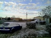
A WINTER STORM WILL CONTINUE TO BRING SNOW TO NORTHEASTERN ARIZONA

TODAY. THIS SYSTEM WILL PRODUCE STORM TOTAL SNOWFALL ACCUMULATIONS

OF A FEW INCHES BETWEEN 3500 AND 5000 FEET...6 TO 12 INCHES ABOVE

5000 FEET...AND 12 TO 24 INCHES ABOVE 7000 FEET. LOCALLY HEAVIER

ACCUMULATIONS OF 2 TO 3 FEET ARE POSSIBLE ABOVE 9000 FEET.


HEAVY SNOW HAS ENDED IN NORTHWESTERN ARIZONA...BUT SCATTERED SNOW

SHOWERS AND FLURRIES WILL CONTINUE THIS AFTERNOON ALTHOUGH ADDITIONAL

ACCUMULATIONS ARE EXPECTED TO BE LIGHT.


WESTERN MOGOLLON RIM-OAK CREEK AND SYCAMORE CANYONS-

BLACK MESA AREA-

INCLUDING THE CITIES OF...PRESCOTT...SELIGMAN...ASH FORK...

KEAMS CANYON...KAIBITO...WUPATKI N.M....TUBA CITY...FLAGSTAFF...

WILLIAMS...MUNDS PARK...SEDONA...NAVAJO N.M.

936 AM MST MON FEB 4 2008


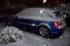
...WINTER STORM WARNING REMAINS IN EFFECT UNTIL NOON MST TODAY...


A WINTER STORM WARNING REMAINS IN EFFECT UNTIL NOON MST TODAY.


A WINTER STORM WILL CONTINUE TO BRING PERIODS OF MODERATE TO

HEAVY SNOW THIS MORNING TO PORTIONS OF NORTH CENTRAL ARIZONA.

EXPECT STORM TOTAL SNOWFALL ACCUMULATIONS OF 6 TO 12 INCHES ABOVE

5000 FEET AND 12 TO 24 INCHES ABOVE 7000 FEET. LOCALLY HEAVIER

ACCUMULATIONS OF 2 TO 3 FEET ARE POSSIBLE ABOVE 9000 FEET. WINDS

OF 15 TO 25 MPH WILL ACCOMPANY THIS STORM. THESE WINDS WILL LEAD

TO BLOWING AND DRIFTING OF SNOW...AND VISIBILITIES WILL BE

REDUCED TO BELOW 1/2 MILE AT TIMES
 
i was all excited when the storm blew thru last week here... we hardly ever get good snow, but it was down to 2000 ft!!
 
Back